Box City Curriculum
A guide for implementation
What is Box City?
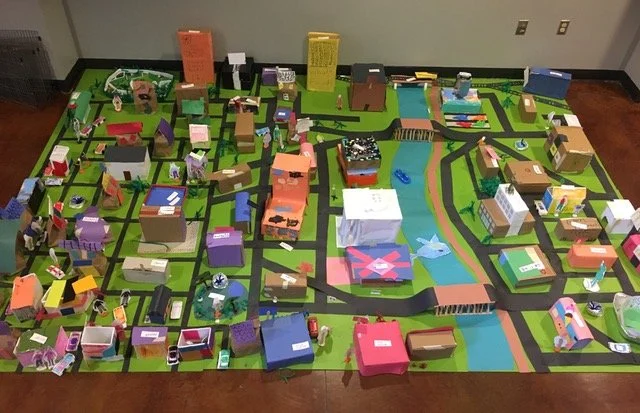
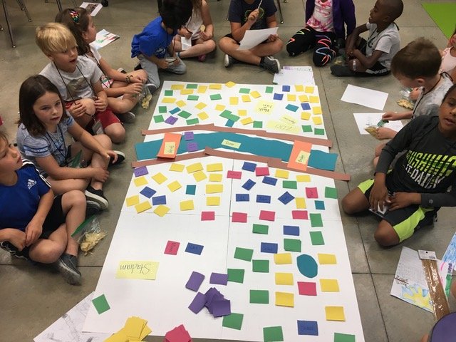
Box City is a three dimensional manifestation of two dimensional plans. Constructed of boxes, participants can “walk" through the city: see space and scale relationships, visualize architectural details, and examine the consequences of zoning, cars, and mass transit.
Box City was developed by architects, planners, and educators as a way to teach planning concepts and provide understanding of neighborhoods and community member roles. Although as a city-planning exercise, participants often learn as much about themselves as they do about their communities.
Who Can Participate?
Box City has been conducted with all ages and can be used with individuals, classrooms, town councils, or at or in conjunction with larger, public events. This project works well when public leaders cooperate on the unit. However, it can be conducted independently by an individual teacher in any curriculum area.
Participants: All ages can participate and apply educational (art, design, patterns, planning) concepts at all levels:
Preschoolers and Kindergartners learn about their family, neighborhood, and city helpers
Third graders use it to learn about community
Fourth and Fifth graders to learn about state and local history
Sixth graders: Ancient Civilization
Middle school students: Government
High school students: Leadership skills
College students, Business, Government: Math, Writing, History, Music, Art, and Citizenship
Box City is valuable as a teaching tool for adults as well. For example, architects have used it as an informal way to educate school district patrons about the issues and challenges, not just the design elements, which are a part of any new school planning process.
Adults: Box City is valuable as a teaching tool for adults as well. Architects have used it as an informal way to educate school district patrons about the issues and challenges, not just the design elements, which are a part of any new school planning process.
Elected Officials: It is an opportunity to invite your city planner and council person and mayor to actually see what good ideas might be tried in your neighborhood or town.
What Participants Can Gain
Participation demonstrates the power of speaking out and taking responsibility. Learned early, this is a powerful tool for community development as well as an important lesson to learn in any stage of life! Box City:
Incorporates concepts from history, geography, art, politics, city planning, and economics.
Instills understanding of the development of cities and their present problems and successes.
Encourages skills in group cooperation, writing, art, mathematics, spatial relationships.
Provides an experiential learning opportunity for participants of all learning skill-levels and styles to successfully participate.
Demonstrates the need for historic preservation ethics and future planning of neighborhoods, towns and cities.

About The Curriculum
This curriculum contains suggestions for planning, construction, and post-construction activities and can be personalized based on participant size, age, place setting, and time frame. Box City is purposefully open-ended and does not contain all of the answers. Those answers will come as the project unfolds.
Box City is an example of Project Based learning (PBL), which is a teaching method where students learn by actively engaging in real-world and meaningful projects that require them to investigate complex questions or problems over an extended period.
Time Commitment
Box City can be a single-day event, weeks-long activity, or school semester project. It is also popular at public events as an introduction to built environment education, architecture, engineering, planning, and public service concepts.
The curriculum offers material for both short and longer forms of the exercise.
Learning From the Past
Early Civilizations
exhibited sustainable development characteristics by using easily available materials, existing geographic formations, and natural energy sources. What can we learn from them?

The Anasazi Indians on Mesa Verde
were able to both shade their settlements from intense summer sun and absorb sun during the winter. Additionally, the mesa itself protected the village from winter winds.
The Settlers of the Midwest
produced a dwelling well-adapted to the climate. Built of a common natural material, the Midwest sod house faced south to absorb winter sun while protecting the structure from northern, cold winter winds.

The Greek City
Although early Greeks are well known for their city planning, their principal cities were not planned, but evolved. The cities were impossibly noisy and hard to navigate. Although the citizens recognized the problems, ancient civilizations never attempted to rebuild an established city unless it had been completely destroyed by war or natural disasters. They would build, instead, in a new place and when they did, planning principles which are common today were put in place.
Cities of Today

Philadelphia, PA
William Penn commissioned the surveyor Thomas Holme to lay out the city in 1682. A rigid gridiron plan was adopted. Two major streets crossed in the center of the town and formed a public square. A square block park was placed in each of the four quadrants of the city. The early dwellings were single-family houses. In the middle of the eighteenth century it became a common practice to build dwellings on the side lot lines resulting in continuous rows of buildings which cut off access to the rear yards. Alleys were then cut through the center of the blocks. These alleys have since become the quaint and narrow business and residential streets for which the city is known today.
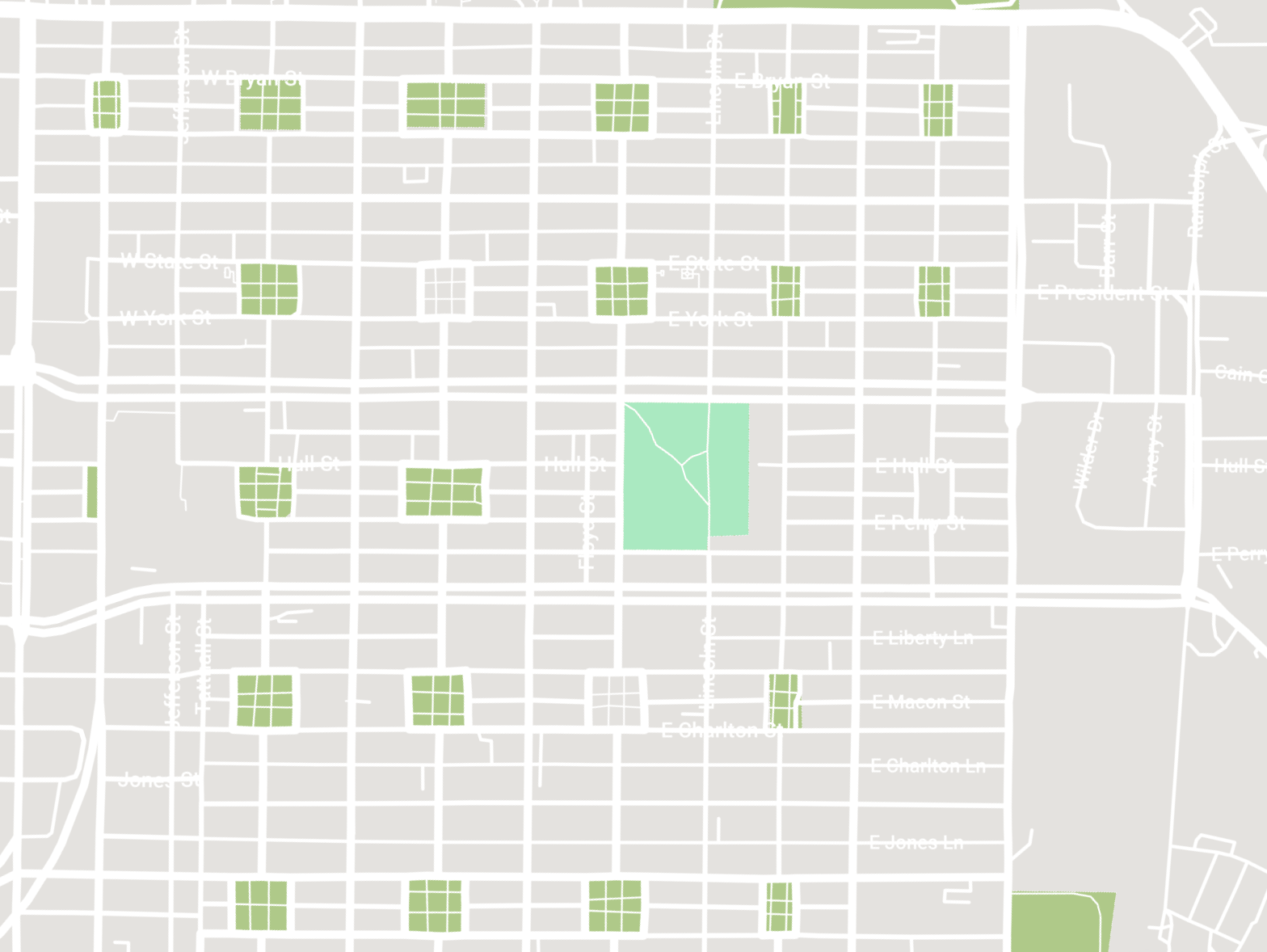
Savannah, GA
Laid out in 1733 by James Oglethorpe, Savannah was a regular grid pattern of rectangular streets with park squares liberally spotted in alternate blocks. Each park is different in foliage and focus: sometimes a gazebo, sometimes a fountain or monument. Savannah is similar to Philadelphia with a more generous allocation of open spaces. The streets linked these parks and created a continuity of open space when the town was built only with single houses.
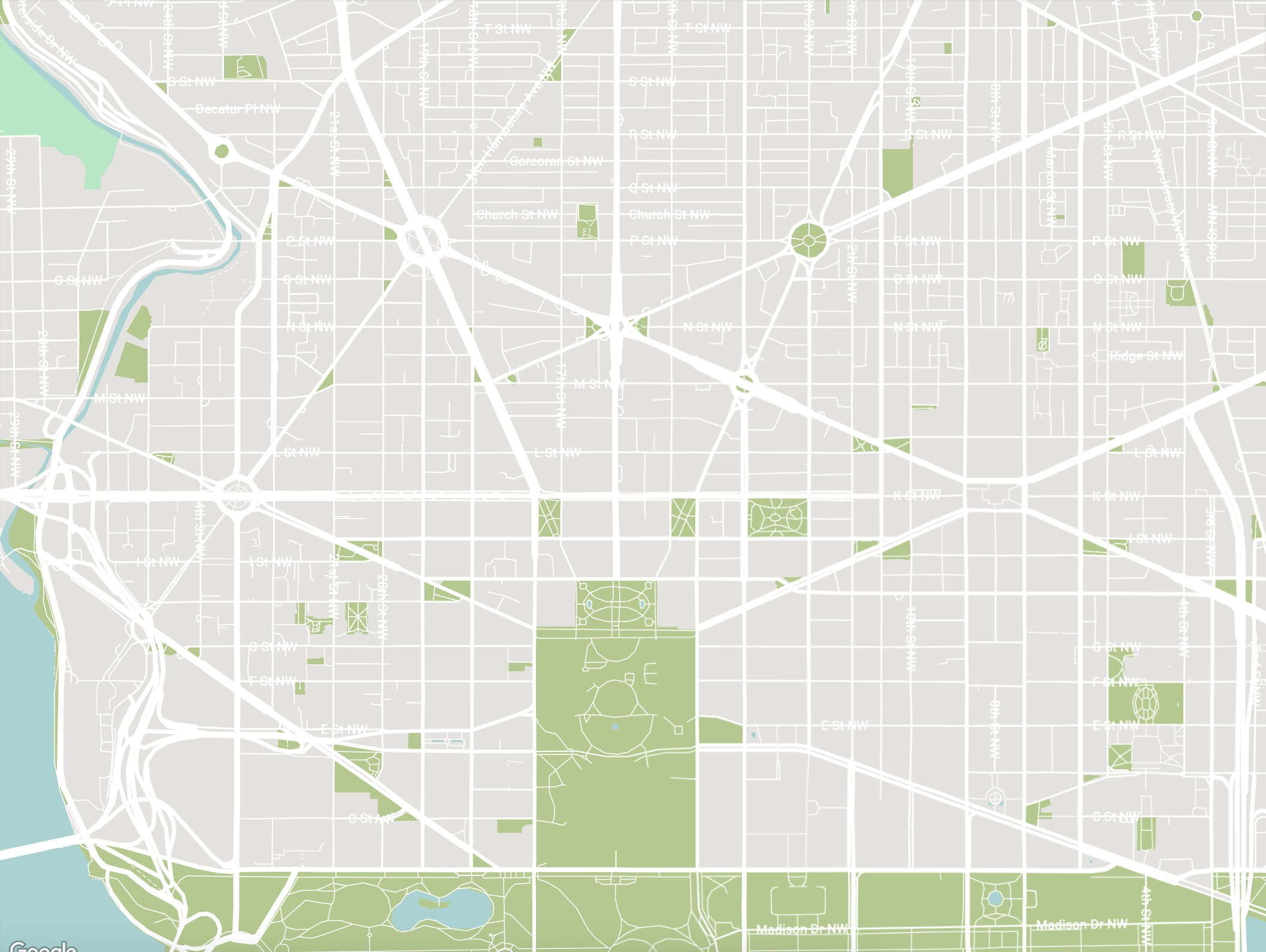
Washington, D.C.
In 1649 Annapolis, Maryland.was the first american city to adopt a layout of diagonal avenues and circles. Washington D.C. followed suit with an even more dramatic display, designed by French designer Major Pierre Charles L’Enfant. He was selected by George Washington for his celebration of the Baroque planning of Paris, which appealed to the aristocracy of the United States.
L’Enfant began, not with the gridiron street system, as city planners of today might do, but with the principal buildings and squares. “Lines or Avenues” of direct communication were laid between these cardinal points and diagonal streets were overlaid upon a gridiron pattern, “a series of interwoven spider webs” as stated by historian Lewis Mumford.
A Movement in Sustainability
Sustainable Development
The sustainable development movement advocates policies that encourage development that is environmentally benign and respectful of community character.
Recycling a building uses fewer new construction materials and addresses resource efficiency. This avoids adverse environmental effects from logging, mining, or other resource depletion, and from the manufacture and transport of new construction materials. In addition, adaptive reuse does not require new land or infrastructure.
Elements of an Environmentally-Sensitive Development
In the same way that a real city might endeavor to retrofit their community and make it more responsive to environmental issues, an eco-city concerns itself with the following issues:

Phase I:
Conservation of water and energy, reduction of waste stream, community recycling, consumer and academic education, planning for future resource use, urban gardens, preservation of neighboring agricultural lands. Reduction of night sky pollution.
Phase II:
Development of mass transit, urban tree-planting program, urban agriculture, pedestrian-friendly developments, retrofitting older buildings, creating social programs to meet local needs, strategy and forecasting system, tracking of all social and environmental services both paid and volunteer to create a coherent whole.

Phase III:
Local markets rather than imported, avoiding fossil-fuel intensive goods, full-scale recycling program of all commodities, life-cycle analysis costs of all products, cost of environmental degradation and resource depletion, eco-tourism such as arboretums, eco-theme parks, “envirotainment” such as children’s museums and theatre.
Discussion Questions
Does our city have a master plan? An updated land use plan? If not, is it working toward a future plan?
Does the city layout create workable streetscapes?
What is the state of historic preservation in our city today?
What is the city doing to preserve or create a sense of community to its neighborhoods?
What incentives are there for developers to re-use buildings? For businesses to re-establish themselves in older parts of the city rather than move to the suburbs?
What are the qualifications of those appointed to planning commissions and other committees responsible for the aesthetic as well as physical quality of life in our city?
Terminology To Be Familiar With
The Built Environment
The “built environment” is a community as a whole, not separate parts. The built and natural environments are one and interdependent.

Sprawl: A City Without A Planned Future
The dictionary definition of the word “sprawl” means to spread out carelessly. Sprawl is uncontained and unplanned development which stretches as far as the eye can see and usually sparked by commercial enterprises out of touch with existing communities. Sprawl often affects communities with more commercial space than the local economy can absorb, competing with existing (often locally owned) businesses.. Downtowns have to rethink their purpose to grow and thrive.
Activities To Get You and Your Participants Thinking
Walk Around The Block (Field Trip)
Walk Around The Block is another CUBE Project Based Learning activity where you yourself, or with a group you're leading, take a field trip to explore the city. Visually exploring the city provides a glimpse of other lives, other ways of doing things. Field studies are essential for a complete education. Take pictures!
With a basic understanding of planning terms like node, district, landmark, edge and path, participants are able to identify strategic areas on a base map of the field trip destination prior to the activity. Experiencing the planning elements on site provides motivation for continued investigation.
Survey Report
The Survey Report is a short oral description of their building (Box) that is made when placing it in the city. When you or the team are on site or researching the neighborhood, make notes and drawings and take photographs for the report. It should include, but is not confined to:
the date built
the architect or family who built it and interesting architectural features
the construction materials, design, decoration, signage, and the way it fits into the neighborhood
anything historically significant (particularly great quotes)
issues and challenges that may affect the building’s future, such as age, quality, function, and use
Scavenger Hunt
Everyone likes a good scavenger hunt. Keep it to about 10 items, with simple illustrations and tie-ins to real town buildings. Ask questions like:
Can you find the clock tower? What time is it in Box City?
Where is the eagle on a flagpole? What does it stand for?
How many domes can you find?
Can you find a building with three round windows?
Can you find the hospital?
Who is sitting on the bench in front of town hall?
Where are the crosswalks?
How are the trees planted?
Make Space For Your Box City

What is the best grid size?
We probably get more questions about creating a grid than any other topic. Allow a space of about 24x24 feet, the approximate size of a standard classroom. That way you can allow for "sprawl" or a suburb or park. A 15x15 foot space would be the minimum. Be creative with the space you have!
*Most people do Box City for about six weeks and then set up their entire Box City for only a day or two in a special place where everyone can see, like a Library or City Hall.
Starting Your Box City
Understanding the Layout of the City
People influence the city when interacting with geography, nature, government, history, and economics.
Here are some starting points:
1.
Begin with what the participants know
the neighborhood around the school
the neighborhood around the most frequently used shopping center
the future plan for your town or city
2.
Contact the city planning department
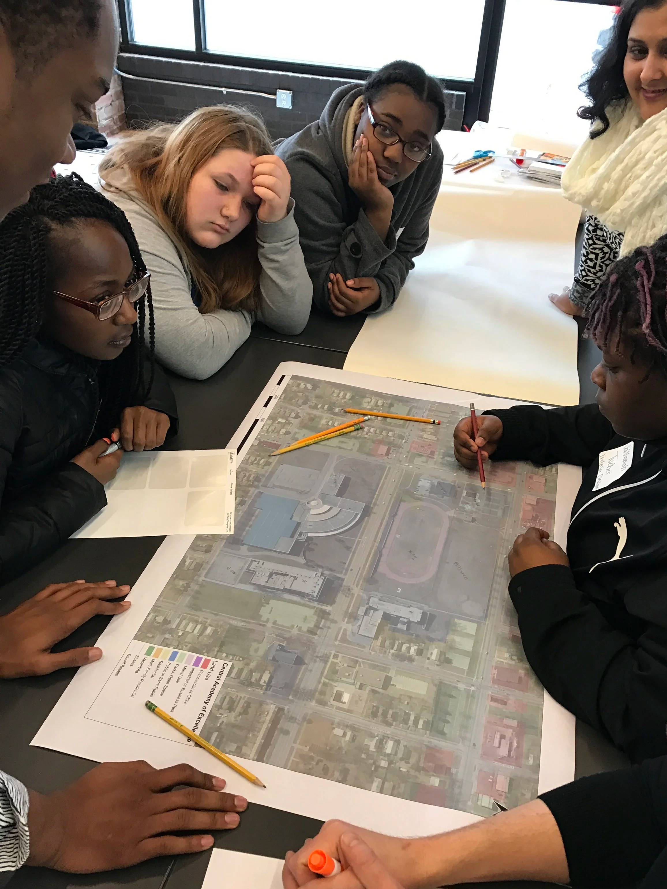
Ask for a land use map of your city, delineated by color. In order to personalize the Box City experience for your participants, this can serve as a drawing guide for the base map.
3.
Define the city boundaries
If curriculum outcomes would benefit, select a certain time period, a particular city or geographic location. Begin with the early nucleus of the city and then have a second wave of construction which represents more current growth in the city.
4.
Write a clear description of the city before
This can be a cooperative learning project if participants can work together over an extended period of time.
For instance:
“This community is located in the rural Midwest in the early 1800s.
It is located on the Missouri River near a place where fur traders had first established a trading post. The first settlers are just moving out of their sod houses and beginning to build more permanent homes and structures. What buildings would they build first?”
Consider The Neighborhood’s Layout and Box arrangements

Services
What public services or needs do people in a neighborhood or city share—police, fire, schools, parks, utilities for electricity, maintenance, landfill?
Where are these places located? In your neighborhood? In your city?
Where should they be? Who decides where these will be? Do you want to live near them?

Transportation
How do you get from one neighborhood to another? From one place in the city to another?
Which ways are the quickest? Why? Should there be more of these routes?
If so, what changes will need to be made in order for this to happen? What will be the positive and negative effects? If asked to move from your home for highway construction, would you? Why or why not?

Greenspaces
Are there green spaces in your neighborhood? In your city? Why? Where?
A green space is not always a park. It can be a planted area with grass and trees, which separates two land use types such as residential from commercial buildings.
Who takes care of the green spaces? Should there be more green spaces? Who should pay?
Rights, Responsibilities, and Limits
Does a building have rights?
Who is responsible for someone else’s land? Your neighborhood? Your city? How far does that responsibility go?
When is it “my” neighborhood? When is it “their” neighborhood? at the corner? when you step outside your house? across the street? a few blocks away?
Identify the types of structures and services which the participants want or consider necessary for a well-run city. For instance, a city will include buildings in the following categories:
Public/SemiPublic
City Hall Courthouse
Fire Department
Jail
Police
Grade school, College
Art Gallery, History Museum
Sports Facilities
Hospital
Commercial
Fast Food, Coffee, Ice Cream
Beauty Shop
Pharmacy
Grocery Store
Bank
Insurance
Law Office
Movie Theaters
Office Building
Industrial
Waterworks
Factories
Power Plant
Airport
Train Station
Bus Station
Heliport
Residential
Single Family, Duplexes, Apartments
low rise (2-4 story)
high rise (5 and up)
Retirement
Mobile Home
Religious
Synagogues
Churches
Mosques
Cathedrals
Parks/Recreation
Parks
Community Center
Green Belts
Rivers, streams
Box City Materials
Get Resourceful
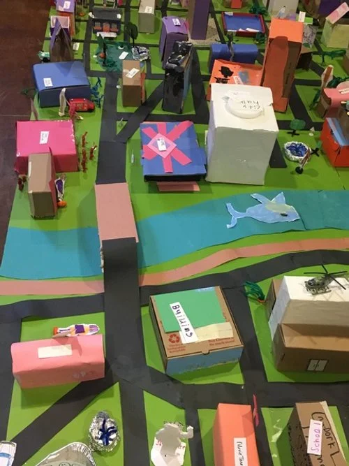
The Box City activity is as much about the process of community-making as it is about the way buildings look. Box Cities are constructed of boxes, often recycled, and sized 4–6 inches, which will help the Boxes relate to scale. See More on Scale in this curriculum. Reused boxes from home or local grocer or business make great opportunities for unique shaped buildings, color, and graphics.
A selection of photos taken on walking tours or reference books will help participants recall specific architectural details. For participants who enjoy research, this is an opportunity to choose a style they have always wanted to learn about.
Boxes of this size allow for easy management and adequate building representation (industrial, commercial, civic, and residential) to form a comprehensive city. The boxes are decorated with paper, paint, rubber stamps, photos, construction paper, magazine cutouts, etc., to encourage a developing knowledge of architectural details and styles.
| Supplies for Box City | Quanty |
|---|---|
| Boxes (could be recycled materials like shoe boxes, cracker boxes, etc.) | 2-4 per participant |
| Rulers | 1 per 2 participants |
| Safety Scissors | 1 per each 2 participants |
| Water Base Markers, assorted colors | 1 box per 4 participants |
| Colored Poster Board, 20” x 30” | 1 per 8 participants |
| Colored Construction Paper, 9” x 12” | 2 sheets per participant |
| Glue Sticks | 1 per 2 participants |
| Masking Tape, 1/2 or 3/4” x 60 yards | 1 roll per 8 participants |
| Magic Tape, 3/4 x 1296” | 1 roll per 4 participants |
| Felt tip Pens or markers, assorted colors | 1 package per 4 participants |
| Aluminum Foil (for roofs, water) | 1 roll |
Choose on of these options for your base:
| Thin tablecloth (use acrylic paint to make a grid) | 1, 60” x 60” or larger |
| Brown wrapping paper | 1 large 24” or 36” wide roll |
| Plastic drop cloth (use acrylic paint to make a grid) | 1 large piece |
Establish A Base Model
A base model is a fundamental, two-dimensional representation of a specific area or neighborhood, like a property or a larger part of the town. It serves as a foundational document, detailing existing features (streets, natural conditions), and is often used as a starting point for developing more detailed design and construction and projects.
Consider and Discuss
Decide on the basic layout for the city. The “Base Model Committee” may be the assisting group of design professionals, a participant committee, or a combination of the two. A discussion of the issues involved, long term impacts of certain planning decisions, and what the base model will actually depict—imaginary or generic city, your own city, or your own neighborhood—need to take place prior to any design work.

A general guideline for land use is:
15% infrastructure (roads, bridges, utilities: water, waste, power; public transit)
15% urban (higher density, setbacks, types of use)
20% civic spaces (parks, public buildings, hospitals, fire/police stations, sports stadium)
15% social and cultural (schools, museums, libraries)
20% housing spaces (variety of choices in terms of type, lifestyle, cost, convenience)
15% working spaces (convenience, variety, flexibility and reusability) can overlap, integrate with other land uses
Discussion
How will you present it?
What scale will it be?
Where will the boxes come from?
Does it need to be movable?
Will it show topography forms?
Constructing The Base Model
Some options to consider:
A thin fabric, such as a tablecloth, as well as some inexpensive acrylic paint diluted with water. Paint helps to stiffen the fabric. It does not need to be done with any precision. Paint the fabric on top of a heavy-duty plastic. Once the paint dries and it should create a slick finish on the underside. A heavy-duty plastic will prevent the fabric from sticking, unlike newspaper.
Strips of brown wrapping paper can be taped together and the street grid painted or marked on this background.
A large white sheet can be marked with permanent felt tip pens. One of the most flexible methods is a bedsheet dyed green, and black strips of construction paper which can be arranged and rearranged as the city grows and develops and as the participants gain more understanding of city planning.
Pace and Scale


Pace and Scale is an advanced tool for translating human measurement [pace] to the size and dimensions of buildings and parts of buildings such as a door, window, classroom, a tree or even an entire facade of a building. Use this tool for translating math to proportions and the size of our world.
Understanding pace and scale will help you lay out the base model for your city. Scale means that the drawing has the same proportions as the real building, only reduced in size. An often used method of measurement is pace. This gives a “rough estimate” of the size of a large area such as a classroom or a building site.
To determine one’s personal pace, stand against a wall, take three average or normal steps. Mark the place where the front of foot lands on the third step. Measure the distance from the wall to the end of the third step. Divide that distance by three. This is the average length of your pace. Based on measurements, determine average pace in inches.
1 pace =__ft. = __in.
Using pace as the unit of measure, draw a floor plan of your room or the place where you are working. Include symbols to represent windows, doors, tables, and other furniture so that others can read, view your drawing. Write the scale on the drawing. Use ¼ inch graph paper to help with proportions.
Something to Consider
Consider public relation opportunities. Box City offers an opportunity for positive public relations for your school or organization. Contact the local newspaper as the actual date of the City construction project draws near. Prepare a simple handout which explains the objectives of the Box City experience and why your school is doing it. Built environment education is interdisciplinary and involves all curriculum areas and all skills.
Educators and participants can have a positive effect on mayors and city council-persons. Schools can involve city officials in the final design of Box City. It is important for officials to know that citizens are interested, have ideas and care.
Creating a Vision
Box City reflects the same kinds of neighborhoods and communities where the participants live. To be able to design the community in a different way requires the participants to have a vision of something else. Creating that vision, which will include a different kind of thinking, is the first consideration of Box City. Understanding alternative patterns is the background work for that process.
Does Your City Work for You?
Address what you want the community to do for you before the layout and guidelines of the city are established. This activity can also serve as an evaluation tool when the City is built. Participants should make a list of the things that make the city a good place. Ask the participants to list the things that are important to them. The two lists may not be alike, but Box City should include some of the things on both lists for it to work for all participants. Choose one residence [box] and pretend you live there.
How does your city work for you?

How easily can you walk to:
school
a church
a grocery store
a library
work
day care
shopping
small services: post office, shoe repair or drug store
a park or green space

How easily can you drive to:
the place of work
a place to take a plane or train or bus
a museum or art gallery

Is there a designated place to:
Bicycle or park your bike
walk a baby in a stroller
jog
sit and chat with a friend

How does your city work for others?
Are people linked with surroundings, or cut off by automobile freeways?
Are there narrow streets to slow traffic and bike lanes to assist cyclists and pedestrians in crossings?
Is there a pattern of public squares, circles and parkways integrated with buildings and pedestrian pathways?
Is there room for sidewalks, trees, playgrounds, alleys and front porches?
Are residences closely arranged near schools, churches, stores and offices?
Are there major streets or boulevards where one can see important landmarks (view shed)?
Guiding Principles for Town Planning
Many designers think beyond current planning code, and allow for more imaginative planning. Things to consider:
Housing is no longer separated by income or age.
Break tradition with the automobile and a street dominant grid. It can change the character of neighborhoods, landscaping, and the inhabitants' perception of community.
Create a commons, square, or large gathering space or plaza.
Design ecologically—save existing habitat; incorporate environmental guidance into development; keep water on the surface, not in storm drains; plant trees and plants that provide shade and food.
Guidelines for Box Placement in the City
The participants need to consider the organization of their buildings (boxes). When the boxes are decorated, how will they be placed in the Box City? If you have used a zoned grid pattern for the base model, this placement is already defined by area. If not, your city will develop organically and will eventually need some organization. Finding this out during the Box City placement can be a part of the learning process. In the real world this is an expensive learning process for a city and its taxpayers!
The following may help the team think through the areas they want to define and their uses:
In city development, civic buildings and streets are often placed first.
Public services (electricity, water, sewer) are developed at the same time.
Residential neighborhoods develop around services.
Schools, industrial and commercial (shopping, restaurants) development responds to housing and population growth.
Appoint or elect a Box City planning and Zoning Commission among the participants in order to become familiar with city planning principles and zoning laws. This group will rule on variances when laying out the city. In terms of zoning, the following guidelines are generally true. Even with a definitive code, exceptions are always made and this is why city planning and zoning commissions exist. Discuss the reasons for the following generic restrictions with the participants.

Residential
Must build adjacent to:
school, library, church, or park
another residential development or hospital

Commercial
Must build adjacent to:
City Hall
park
library
another commercial development
should be integrated within neighborhoods

Industrial
Must build adjacent to:
river, railroad, highway, airport
another industrial development cannot build adjacent to church, school, library, residential, hospital, parks
Discussion
Find out if participants (or their parents) have ever attended a city zoning meeting and for what reason.
Exploring Your Neighborhood
Think about how the city works by considering how people move from place to place and what helps them to do that.
Cognitive Mapping
Begin with a base drawing that shows the area between home and school or work. Once you have made the base drawing, write the words and symbols that city planners use on a specific area of the map. One might use color to differentiate the designations, i.e., red for path, blue for landmark and so forth.
City Planning Vocabulary:
Path
Channels along which you move. Walkways, streets, highways, rivers are paths.
Q: Can you map the path from your house to school?
Edge
Boundaries between two regions. Rivers, forests, valleys, and hills all create edges.
Q: What are the boundaries between two zones or regions?
Landmark
A physical object, sometimes visible from a distance, such as a sign, building, or natural feature. ex: public sculpture, special public buildings, historic sites, shopping centers, restaurants, gas stations.
Q: What are the visual or physical signals that help you reach your destination?
Node
Strategic spots in a city, sometimes junctions or crossing of paths. A concentration of visual information or physical activity.
Q: Where do you plan to have busy “gathering” places along the route?
District
An area of recognizable character. Every city is made up of a number of neighborhoods or districts.
Q: What areas are identifiable or of such scale that they could be given a name?
Identify Buildings, Spaces, And Scenes That Make Your City Special
It is only by recording the special places that we can begin to identify what is important in our communities, those places which cry out for assistance, or what we need to pay attention to—those things that represent the “essence” of our communities and make our neighborhoods or cities unique and special. Start a Mapping the Special Places activity for your own neighborhood or community.
The purpose of the mapping activity is to record those special places that could be:

Shared

Enhanced

Protected and preserved
*If mapping a very large area with a group, break it into smaller parts and have each person outline or draw the areas they know best. The information on the maps can be combined at the end.
To get started, close your eyes, mentally roam your chosen area and see what visual images appear. It may be a building, a tree or flower, a sunset, a stand of cottonwood trees, a building silhouetted on the skyline, a monument, sculpture, work of art, recreational area, district, or personally important landmark or space. Ask, “Would my community be a lesser place without this (building, place, statue)?” If the answer is “yes,” put that place on the map. For this exercise, make a base map of at least five important or “favorite spots”. Important spots could also mean old, architecturally significant, historically significant because of a person or event, or significant due to its site or presence.
Consider the following to make sure you haven’t left out anything.
historical interest - monument, landmark, building, geographic, birthplace, archaeologic
architectural interest - design, style, floor plan, materials, site, famous person was there
environmental interest - trees, fishing hole, bike trail, walking path, river
someplace that’s neglected or forgotten but shouldn’t be - old building, overgrown area
places for children - playground, field, stream
“used-to-be place” - now being used for some other activity
personal interest - ‘i remember this place was…’
At the end, make a Base Plan Title Block and write the name of the area you are mapping and your name.
Repeat the exercise with someone you know who could contribute valuable information: an old-timer, a person new to the area, a group of kids. Each base map will be different. Each will say a lot about your city.
Mapping exercises work in both urban and rural areas. Only the scale changes. In a classroom situation, it is interesting to compare the differences in individual maps, especially if the group is involved in any kind of exchange program such as that explained in Make the Connection.
Consider Areas for Improvement
Suggestions for a Better Town or Neighborhood
Use this list as a guide when planning your Box City. Use it as a Report Card when you are evaluating how well your city will work.
▢ Give up Big Lawns
▢ Bring Back the Corner Store
▢ Make the Streets Skinny
▢ Drop the Cul-De-Sac
▢ Draw Boundaries
▢ Hide the Garage
▢ Mix Housing Types
▢ Plant Trees Curbside
▢ Put New Life into Old Projects
▢ Design for Mass Transit
▢ Link Work to Home
▢ Make a Town Center
▢ Shrink Parking Lots
▢ Turn down the Lights
▢ Think Green
▢ Embrace density

Role Play
Why Role Playing is Useful
Role playing gives the participants an opportunity to evaluate through someone else’s eyes. It further encourages participants to consider different perspectives. It also gives participants an active opportunity to exercise problem solving, decision making, logic/argument, critical thinking and precise and accurate recording.
Assigning Roles: Who Can Make a Difference?
For older participants, assuming the role of an actual citizen can stimulate an interest in city government and in individual ownership rights. Assign roles well ahead of time. Participants should research their roles by reading the local newspaper, watching local television news, or speaking to someone in a particular business, as a way of becoming informed prior to the Box City exercise.
Once roles have been assigned, copy the “roles” onto full-sheet label paper so participants can wear a name-tag defining their roles. It is important for the names to be large enough to be easily read across the room.
Introduce writing into the curriculum by having participants write a short paragraph describing the role. In the role description, participants should describe their role, including the workplace, what transportation is used to get to and from work and what stops are made during that process.

Special role: The Mayor
The mayor, as a representative of all of the people, needs to be sensitive to issues of race, poverty, gender, taxes and other sensitive issues. Use the strategy of mandating the citizens’ committee to “improve” less desirable areas with enhancements such as trade-offs for zoning adjustments.
A building owner might be allowed to violate a height ordinance in exchange for running a child-care center in the building or a developer might be given the right to develop in a high rent district with the proviso that low-cost housing be provided. Trees might be planted in a park if the property is too small.
As a spin-off of this activity, participants also learn about career possibilities, real neighborhood or city issues.
After Role Play
Once Box City is complete and role play has concluded, make sure that all participants have returned to their own identity and have relinquished their assumed persona, which was adopted for the purposes of organizing the city.
Set Time Limitations
Determine the time which can be committed to creating the box. If time is limited, consider these alternatives:
Examples of earlier built boxes can provide information and inspiration (and even a little competition) to the exercise.
Participants take a box home for individual decorating.
Work with an art instructor for box decoration during an art period.
Do in the classroom as a group or as an individual project.
Building a Box City
In selecting the buildings for a city, think in terms of these Land Use categories: Commercial, Public and Semi-public, Industrial, Residential, and Parks/Recreation. Urban planners think in these terms and create color coded Land Use Maps. Make color coded blocks for each category to help layout your Box City.
Having participants design their own box will allow them to demonstrate knowledge of architectural details, building materials, and relative scale through the creation of a particular building type.
New vs. Old
Recycling/Reusing Old Buildings
In making the building selection and assignment, address the creation of new buildings as well as the preservation/conservation of older buildings. They can be reset in the same function or adapt to a new use, such as a school or church to apartments.
Understanding the Impact of New Construction
As the participants begin the creation of their Box City, it offers an opportunity for them to begin to see buildings in the context of the whole city, and to think about what they are creating, replicating the same thinking process that architects use. The following may serve as material for discussion:
Are the surrounding buildings, as well as the whole city, a better place or a worse place because of the addition of this building?
How does the building relate to a historic building already in the area? Does it imitate the building which would destroy its uniqueness? A new building must relate to the future. Its life will take place 100 years in the future.
How can the construction materials enhance the building?
How does the architecture look on the skyline? At street level? Does it connect or fit with other buildings?
Will the building help inhabitants recognize the character of the city from a new perspective?
Abbreviated Instructions for Leader
These abbreviated instructions give an overview to the leader or design professional who actually supervises the “placement” of the Box City boxes.
Lay down the grid. Assign zoned areas by laying out colored construction paper, which responds to special use, i.e., green for park facilities. Pass out role playing name-tags. Name the streets.
Reconfirm the guidelines for this particular Box City. For instance, “This is a Boomtown. A factory is located on the river. There are no pre-existing buildings, however there are highways, bridges,” and so forth.
Appoint mayor and zoning committee (3) from among participants and give them zoning definition sheets for easy referral.
Begin with the most appropriate area for placement: usually Civic, unless there is a special situation.
Allow participants to describe their Box City box, its use, its most important architectural detail (materials, ornamentation, roof, floor plan, walls, openings, etc.) as they place their Boxes. Bring in structural knowledge by asking how their building stands up.
If a Box City box placement seems fine, issue an occupancy permit, move on to the next one. If not, ask for opinions from the zoning commission. Here is an opportunity for you, as a professional, to insert your knowledge.
When the Box City is completed, conduct an overall discussion of what else the participants would add to make it better, or what is missing? Finalize the discussion by asking, “What did you learn today?”
Participants usually want more time to add additional boxes that they have left out.
Be sure to document and photograph the town layout as it develops and for sharing with future Box City projects.
The City has been built, the placement and replacement has taken place. What next? What else is there to do with Box City? Help participants reflect on the Box City they have created.

Evaluating Your Box City
Following the Box City exercise, participants evaluate the city with a leader or with a design professional in architecture or city planning in order to promote higher level thinking skills by using comparison, judgment, evaluation, and future planning.
Report Card
Write a "Report Card for Box City” or a community using the guidelines you set up for developing the Box City.
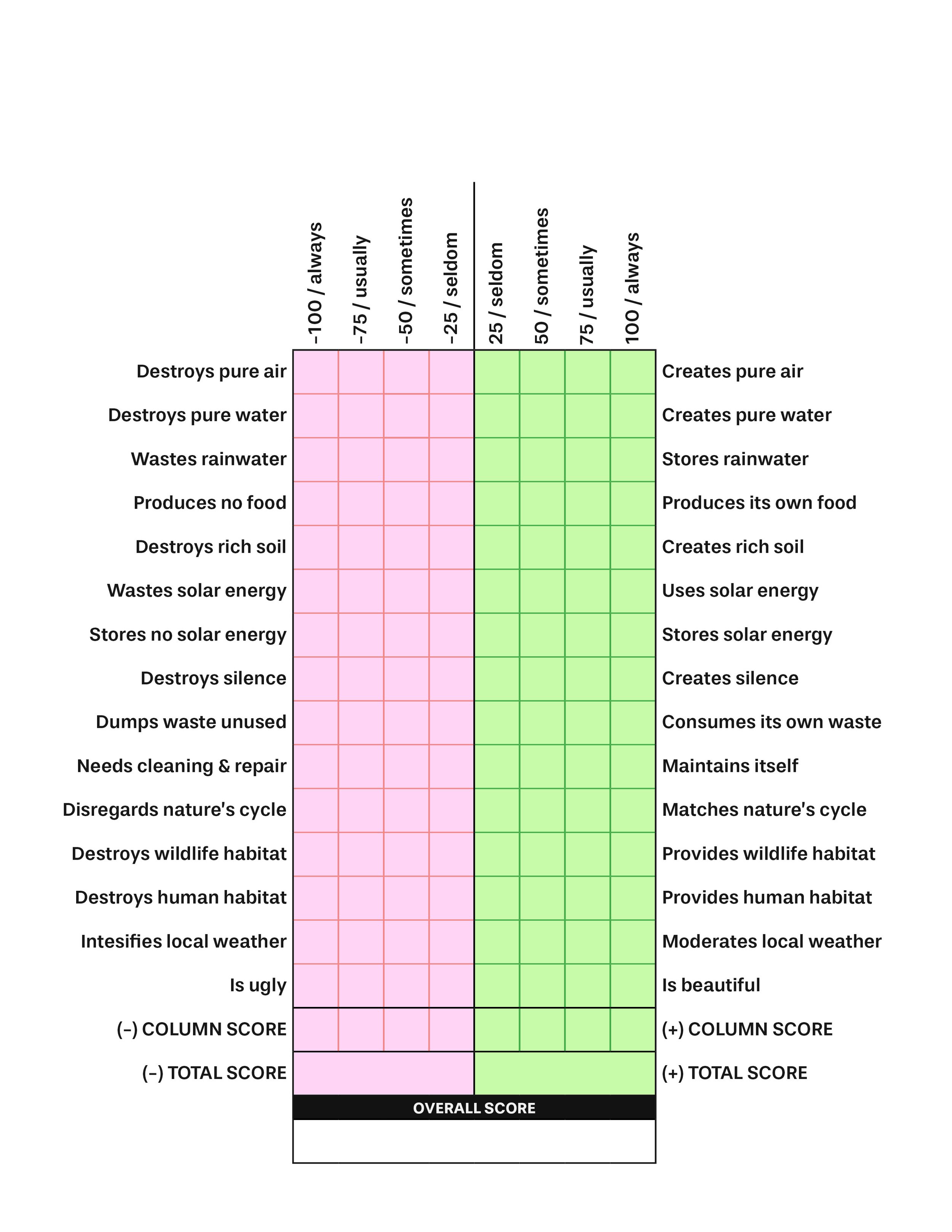
Architecture Report Card
An Architectural Value System / designed by Malcolm Wells
Wrap-Up Question
What did you learn from this activity?
Box City and Beyond / More Ideas
Article for the “Local News”
Participants can write an article with illustrations for The Box City News. Younger participants may simply draw a view of the city.
Travel Brochure
Who will want to visit the city? What will they experience? What should they see first? A travel brochure or video is natural. This might be presented to guests or parents in order to help focus their thinking.
Cube Background
The Center for Understanding the Built Environment, CUBE is a community-based education organization providing curriculum and assistance to create an awareness of the built environment and to enable people to take responsibility for their community. Founded as a not-for-profit in 1983, CUBE develops curriculum materials and recognizes outstanding built environment educators. Visit the website for more information: www.cube-education.org
A Brief History of Box City and CUBE
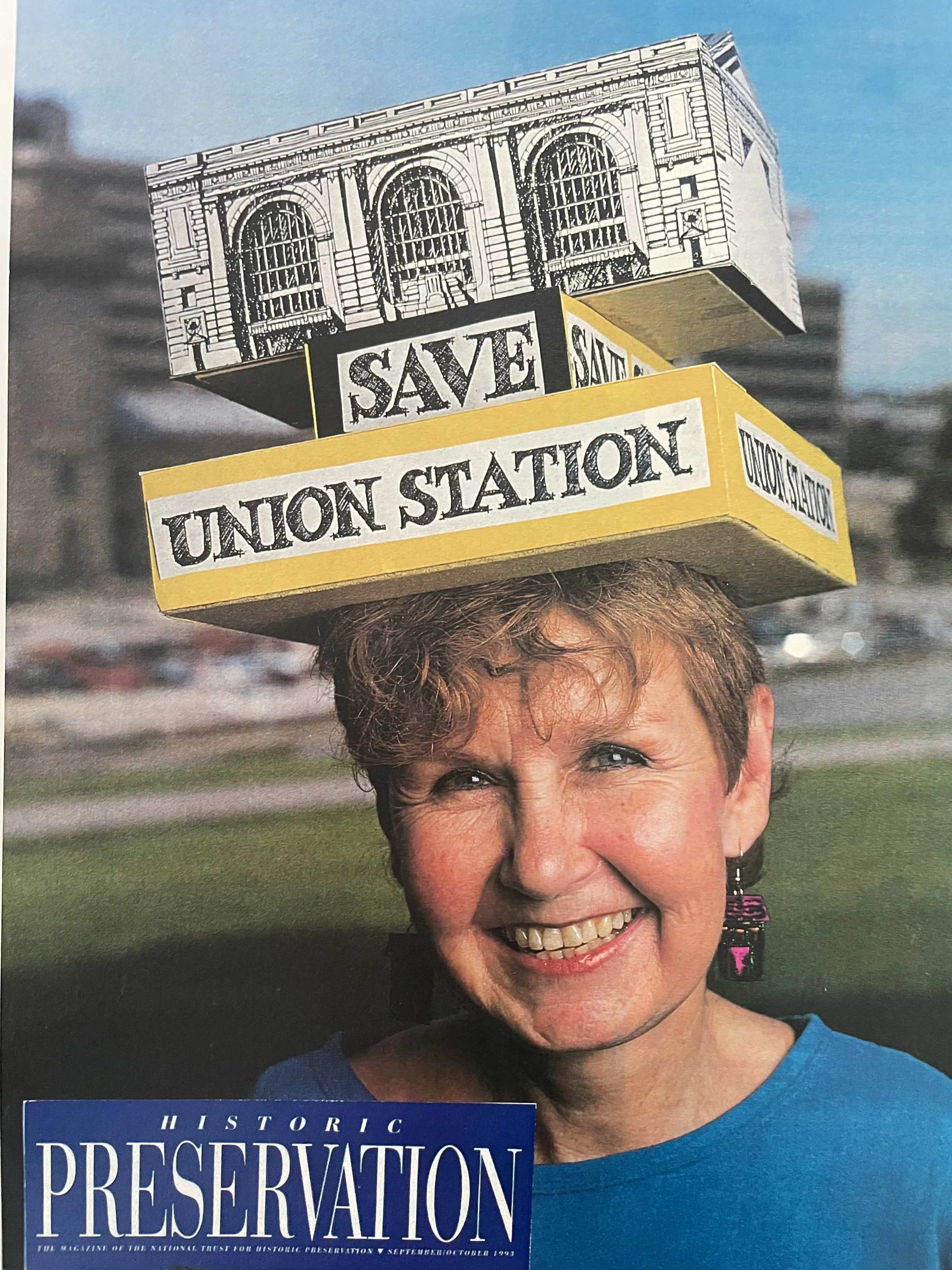
1969
The Beginning - Box City began as an environmental education activity at the Johnson County, Kansas Library’s Discovery Series interrelated arts program. Dean Graves, FAIA and Ginny Graves, HAIA, initiated this effort.
1979
Box City was the hands-on participatory experience for kids at the National American Institute of Architects Convention. For many years Box City was used by AIA chapters around the country as another way to introduce built environment learning into school classrooms.
1986
Box City re-emerges in leader training. Two hundred leaders participated in Box City in an Urban Archaeology class offered by Ottawa University. It was the culminating activity for a city planning unit. The hands-on Box City sessions were preceded by playing the “My Town, Your Town, Our Town” game.
1989
National Building Museum, Washington, D.C., incorporated Box City into workshops.
2020
Box City and Walk Around the Block curricula become available as a free resource on the CUBE website and is distributed to more than 20 countries and throughout the US
2024
CUBE celebrates it’s 75th birthday and Box City’s 45th birthday, which is shared in more than 20 countries, for free.


This curriculum is based on the 1990 original publication, An Interdisciplinary Experience in Community Planning,
by Ginny Graves, Honorary American Institute of Architects (AIA) member and Dean W. Graves, Fellow AIA member. Box City Curriculum was edited by Kirk Gastinger, Fellow AIA member, and Laura Gosa in September 2025.
CUBE is a nonprofit 501(c)(3) organization. While we provide resources like Box City for free, we rely on the support of people like you to continue this work.
Support CUBE by making a donation today via Network for Good.